

The purpose of the AMPERE (Asset Mapping Platform for Emerging countRies Electrification) project is to provide a dedicated solution for electrical power network information gathering. AMPERE can actually support decision making actors (e. g. institutions and public/ private companies in charge to manage electrical network) to collect all needed info to plan electrical network maintenance and upgrade.
In particular, the need for such a solution comes in emerging countries where, despite global electrification rates are significantly progressing, the access to electricity is still far from being achieved in a reliable way. Indeed, the challenge facing such communities goes beyond the lack of infrastructure assets: what is needed is a mapping of already deployed infrastructure (sometime not well known!) in order to perform holistic assessment of the energy demand and its expected growth over time. In such a context, Galileo is a key enabler -especially, considering its free-of-charge High Accuracy Service (HAS) and its highly precise E5 AltBOC code measurements- as a core component to map electric utilities, optimise decision making process about the network development and therefore increase time and cost efficiency, offering more convenient way to manage energy distribution. These aspects confer to the AMPERE project a worldwide dimension, having European industry the clear role to bring innovation and know-how to allow network intervention planning with a limited afforded financial risk above all for emerging non-European countries.
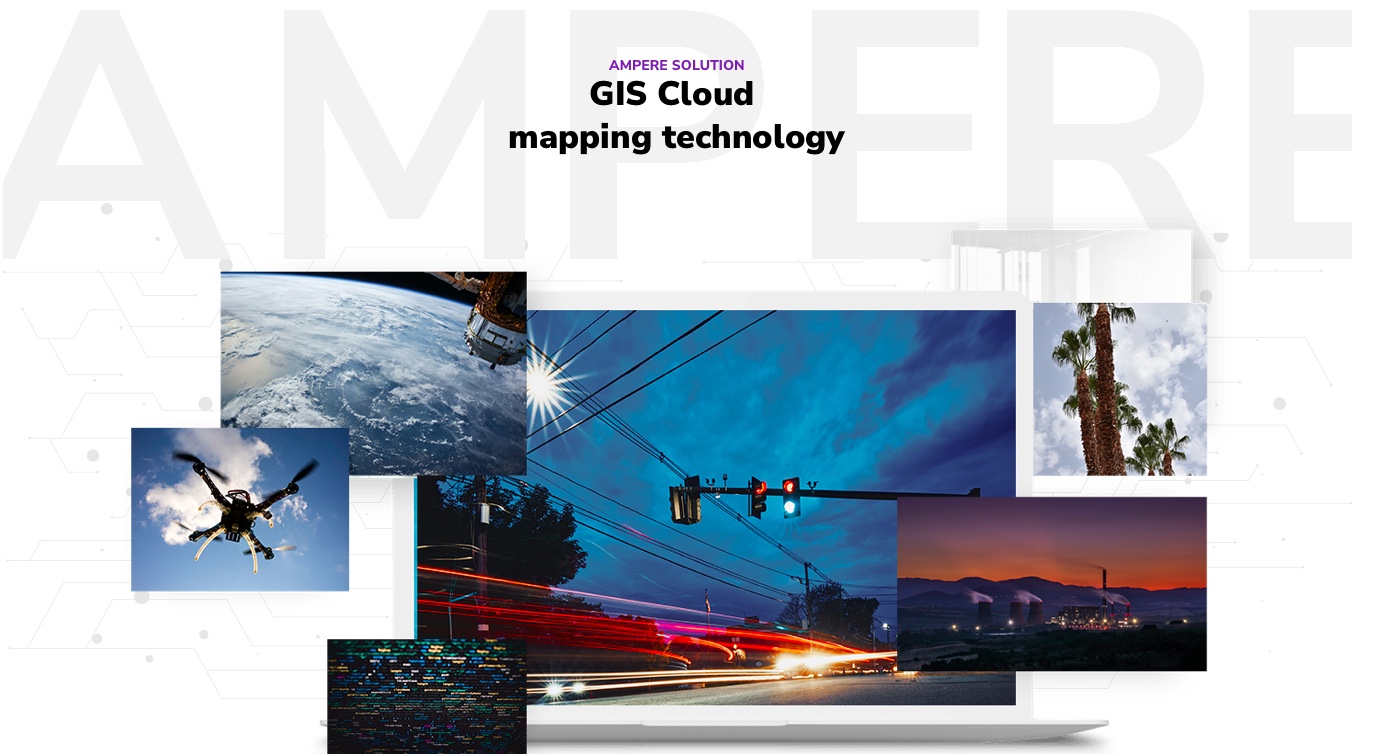
AMPERE proposes a solution based on a GIS Cloud mapping technology, collecting on field data acquired with optical/thermal cameras and LIDAR installed on board a Remote Piloted Aircraft (RPA). In particular, an RPA will be able to fly over selected areas performing semi-automated operations to collect optical and thermal images as well as 3D LiDAR-based reconstruction products. Such products are post processed at the central cloud GIS platform allowing operators in planning and monitoring activities by means of visualization and analytics tools can resolve data accessibility issues and improve the decision-making process. On this context, EGNSS represents an essential technology ensuring automated operations in a reliable manner and guaranteeing high performance.
AMPERE use Galileo advanced features -namely, High Accuracy Service (HAS) and E5 AltBOC- as a core element of the added-value asset mapping proposition. The nature of HAS is fitting very well the requirements of this application, especially due to the re-shaping of the once fee-based accuracy capability to an open, free-of-charge service delivering around 20 centimeter accuracy, versus the below-ten-centimeters PPP services, in lower convergence time.The key of Galileo HAS stands upon the high bandwidth of its E6-B channel, well suited to transmit PPP information, especially relevant for satellite clock corrections, which are not as stable in the medium and long term as the orbits. Additionally, the use of E5 AltBOC pseudo-ranges (which are cm-level precise with maximum multipath effects in the order of 1 m) supports fast ambiguity resolution for carrier phase observations. The Alternative BOC, (AltBOC) modulation on E5, is one of the most advanced signals the Galileo satellites transmit. Galileo receivers capable of tracking this signal will benefit from unequalled performance in terms of measurement accuracy and multipath suppression.
The market is responding actively and positively to multi-frequency enhanced capabilities provided by Galileo. Around 40% of receiver models on the market are now multi-frequency. Also, in the mass market, with the launch of the world’s first dual-frequency GNSS smartphone by Xiaomi, and u-blox, STM, Intel and Qualcomm launching their first dual-frequency products earlier this year, multi-frequency is becoming a reality for user needing increased accuracy.
More information on: https://h2020-ampere.eu
Copia qui lo "short link" a questo articolo
www.geoforall.it/{sh404sef_shurl}
